
NEW: GIS For Hire!
I will now be taking on your GIS projects from home. Please fill out the following form with your GIS related questions and I will get back to you promptly. Do not hesitate to contact me with any of your spatial analysis, raster analysis, modelling, coding or cartography questions, big or small, and I will discuss a solution with you prior to starting the work.
education
I have completed my bachelor’s degree in Environmental Studies from the Clayton H. Riddell Faculty of Earth, Environment and Resources at the University of Manitoba. I have focused my studies in the fields of GIS, RS and Wildlife Management while earning a spot on the Dean's Honour List for 3 consecutive years. I hold credits in courses including:
Advanced GIS
Remote Sensing
Quantitative Research Methods
Statistics
Chemistry
Field Investigations
Wildlife Management
Physical/Human Geography
Soil Science
Environmental Site Assessment
Biogeography
Major Co-op placements (CEOS and DFO)
Certifications
I have obtained a variety of professional certifications including:
Hunter Safety (2003)
Chainsaw Certification (2013)
Hover Exit (2013)
Helitac Firefighter Crew Leader Training/Certification (2013)
ESRI Certification (2013-2014)
CPR-C/Emergency First Aid (2015)
NASA Application of RS to Soil Moisture and ET (2016)
ESA’s STEP Forum User of the Month (2018)
Cansel Survey-grade GPS (2019)
Field of Honour Award (2006)
TDG Certification (2013)
Air TDG Certification (2013)
WHMIS Certification (2013)
PAL/Restricted PAL Certification (2013)
Bear Safety Certification (2013)
M-ITX Computer Build (2017)
4-wheeler operation (2018)
publications
I have both co-authored and contributed to peer reviewed scientific journal publications including:
Soil moisture estimation bias (coming soon, IGARSS19)
“Synthetic Aperture Radar (SAR) Compact Polarimetry for Soil Moisture Retrieval” (published, remote sensing, MDPI)
“Assessing SMAP Soil Moisture Scaling and Retrieval in the Carman (Canada) Study Site” (published, Vadose Zone)
“Comparative Analysis of High-Resolution Soil Moisture Simulations from the Soil, Vegetation, and Snow (SVS) Land Surface Model Using SAR Imagery Over Bare Soil” (published, MDPI)
“Retrieval of Field-Scale Soil Moisture Using Compact Polarimetry: Preparing for the RADARSAT-Contellation” (IGARSS 2018)
“A Method for Assessing SMAP Core Validation Site Scaling Bias Using Enhanced Sampling and Random Forests” (IGARSS 2019)
“Up-Scaling of SMAPVEX16 Soil Moisture Field Data - SMAP Cal/Val Workshop” (author and presenter at NASA SMAP Workshop, Amherst, MA, 2017)
“Up-Scaling of SMAPVEX16 Soil Moisture Field Data - SMAP Cal/Val Workshop v2” (author and presenter at NASA SMAP Workshop, Fairfax, VA, 2018)
work history
Remote sensing and gis for sar microwave analysis
Resource Analysis Technician, Agriculture and Agri-Food Canada

radarsat-2 surface soil moisture
Soil moisture plays an important role in flood forecasting, weather and drought modelling as well as precision agriculture and crop disease forecasting. The ability to map soil moisture is vital in the understanding of many earth processes and can be used in various models to better predict future events.
My role is to acquire, process, validate and disseminate soil moisture data using retrievals from RADARSAT-2, a Canadian Space Agency (CSA) satellite built by MacDonald Dettwiler and Associates (MDA).
RADARSAT-2 SURFACE SOIL MOISTURE
As the data librarian I have created a space where the public can access all RADARSAT-2 soil moisture data which I have processed and validated. The data is made available through the RADARSAT-2 Surface Soil Moisture GoC page. You can click on the link above to open a new window to that page.
RADARSAT-2 is a C-band Synthetic Aperature Radar (SAR) satellite orbiting at an altitude of 798km. I process the Fine Wide Quad-polarized backscatter retrievals using software create by Array Systems. The processed data is output in GoeTIF format and projected to local UTM.
The soil moisture maps are cross-validated against a network of in-situ soil moisture monitoring stations. This network of soil moisture stations is termed the Real-time In-Situ Monitoring for Agriculture (RISMA). I generate statistics for all RISMA stations for a given satellite acquisition using code I have developed in the CRAN language. You can click here to check out the RISMA page, which is the first Canadian soil moisture network to be a part of the International Soil Moisture Network.
Click here to view some of the soil moisture maps. Please contact me if you have any questions about any of the topics discussed above.
Below is a set of soil moisture images produced using RADARSAT-2 SAR data acquired between 2015-OCT-09 and 2015-OCT-10 UTC. For the black and white imagery, lighter areas indicate wetter values and darker areas indicate drier areas. The 1st image is the data portrayed within a map template, the 2nd image is the processed satellite signals to WFV data, the 3rd image is the statistical plot when compared to in-situ measurements and the 4th image contains a snapshot of the data using Google Earth. Click here to view the retrievals in Google Earth.


coding and validation
As part of the AAFC soil moisture project, my job is to validate SAR retrievals using a series of in-situ soil moisture sensors. The process includes acquiring C-band SAR data, pre-processing the data and subsequently processing the data to a soil moisture product using the Integral Equation Model (IEM). I have developed a code in R to ingest processed soil moisture products, identify the time of acquisition, collocate the satellite based data to the ground truth observation using a series of in-situ monitoring stations across Canada, extract the satellite derived soil moisture value representative of each station within the ROI, compare the observed and expected values and generate a series of metrics as well as produce scatter plots to highlight the accuracy of the soil moisture product. The code will also run a series of checks against ground conditions such as frozen soil and precipitation checks against rain events during or between satellite acquisitions.
The code I have developed is currently at version 3.1 "BENDER" (2018-DEC-18). It has significantly reduced the turn-around time between satellite acquisition, validation and posting processed data to the Open Government Data Portal.
experiments
I played an active role in both the Scanning L-band Active/Passive Experiment 2015 (SLAPex-15) as well as the Soil Moisture Active/Passive Validation Experiment 2016 (SMAPVex-16). These experiments were conducted with organizations such as AAFC, NASA, JPL and the University of Manitoba as well as many more. I also co-authored a paper using data from the SMAPVex-16 campaign.
As a main author I presented findings from SMAPVex-16 at the SMAP Calibration/Validation workshops in both Amherst, Massachusetts as well as Fairfax, Virginia. During these workshops various partnerships present ways in which to reduce error from products such as the SMAP Level 2 Soil Moisture Passive Enhanced (L2 SM P E) as well as quantify error within the SMAP retrievals and processing algorithms.
You may view my presentations for both the Amherst, Massachusetts and Fairfax, Virginia workshops by clicking on the respective location.
Currently, along with the aforementioned project, I am working on a SAR decomposition analysis of radar signal within agricultural settings in an attempt to isolate the error within RADARSAT-2 soil moisture retrievals.
Soil Cracking
I have been working on a project attempting to locate and quantify soil cracks using point cloud data collected from a terrestrial laser scanner. Using a combination of CloudCompare and Cran R I have been able to create the preliminary results needed to move forward with this project.

Soil crack laser scan point cloud data

CloudCompare 3d image of a soil profile

CloudCompare 3d image of the scalar height ramp for the soil crack classified with low elevation in red (crack slope) and green (bottom of slope, beginning of laser shadow due to high incidence angle)
Gis Technician
Department of Fisheries and Oceans Canada, Fresh Water Institute

mapping
I have completed a number of mapping projects while working at the FWI, DFO. Below are some of the maps I have produced. You may click each of the images to view the full screen map.


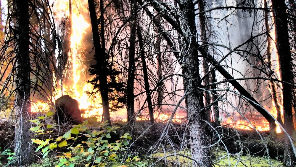
Helitac Wildland Firefighter
Manitoba Conservation

Helitac Firefighting
As a member of the Wekusko Falls Helitac crew I fought wildland fire accross Manitoba as well as within parts of Ontario. I served as 19-4 and 19-2 in 2 consecutive years acting as pump and chainsaw, respectively. Within these roles I performed various duties including wildland fire suppression, cutting helipads, performing hover-exits, value protection within northern reserves in Manitoba and pump set-ups to supply water to active fire lines.
Below are some pictures captured during my time as a Helitac Firefighter.


Other
I have other professional documents which you may view below:
Latest CV (please email for a copy of this document or use the provided password here).
Quantitative research analysis of the correlation between rainfall and time in Vancouver